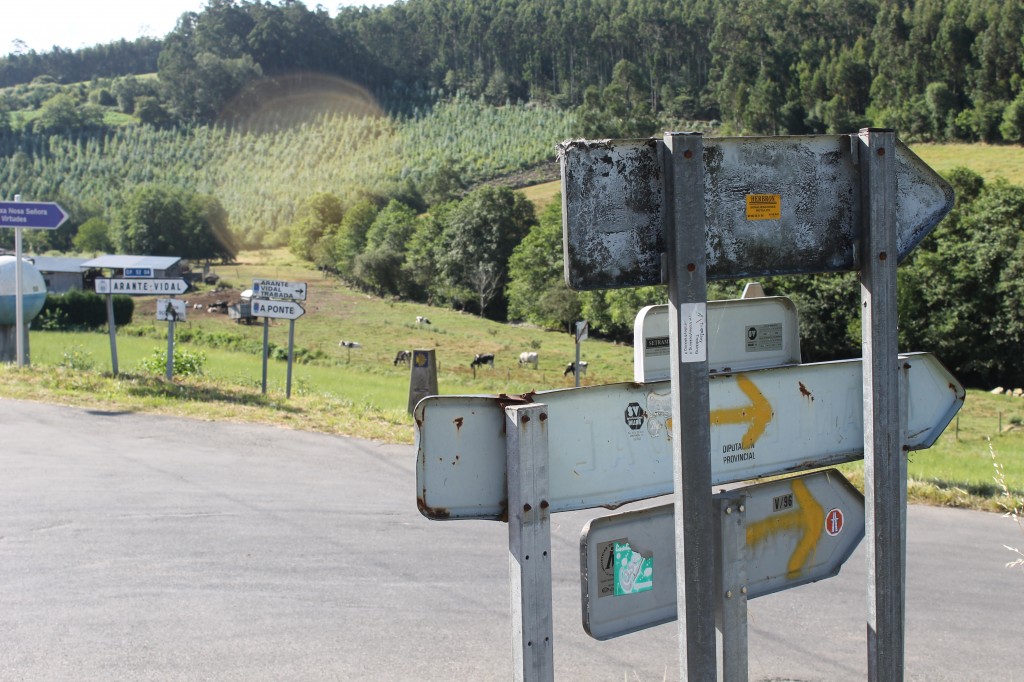
My flashlight bounces off the ground, searching fanatically for a spray painted yellow arrow on anything – a rock, a tree trunk, an abadoned church. It isn’t even 6am yet, and the rain drives down steadily as we pad silently down the N-634 towards Miraz, where we’d spend the night.
Hayley spots the road marker up ahead, just off the highway. The stone obelisk is worn, and the plaque the kilometers to Santiago, long stolen. The mythic 100-kilometers-to-Santiago mark (the minimum distance to get the Compostela) is barely visible between the rain drops and the darkness, but it takes us off the highway and into a dense ecualyptus forrest.
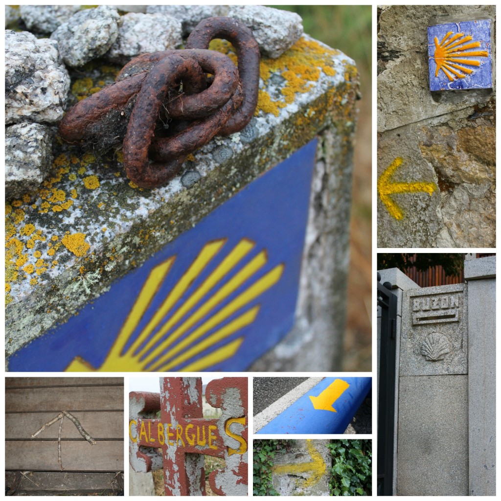
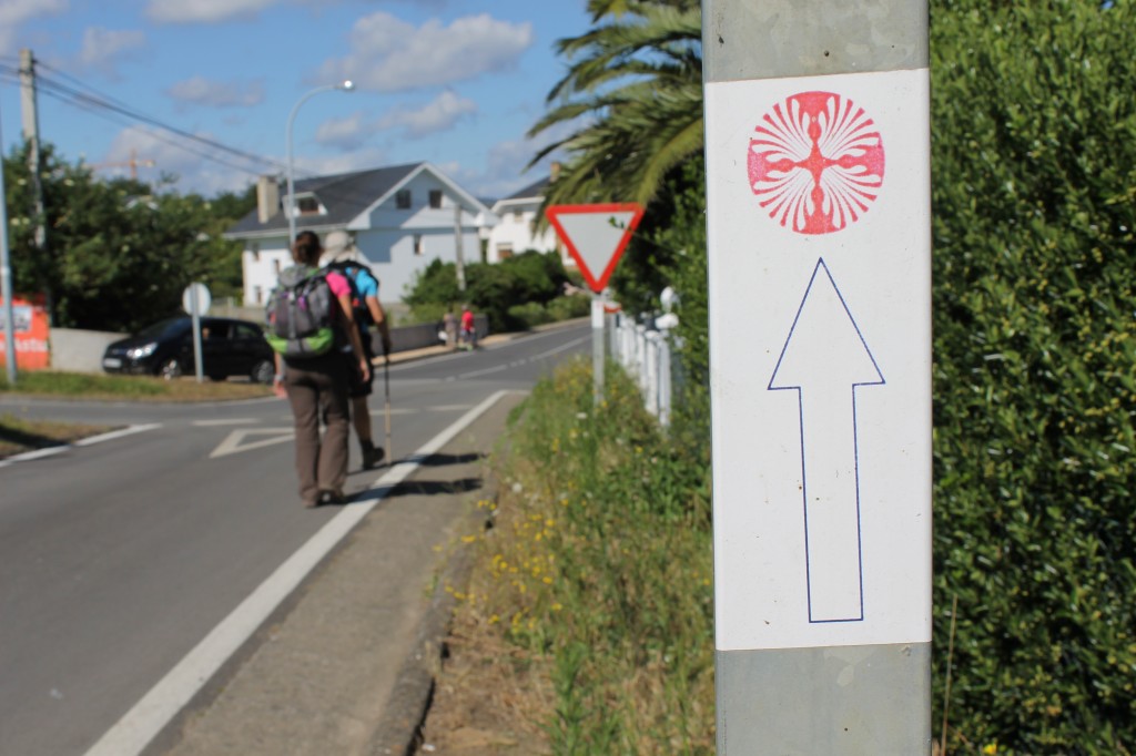
These road markers – but way of yellow arrow, blue and yellow tiles adorned with a scallop shell or even sticks stuck together whenever the former lacked – lead us all the way from Avilés to Santiago de Compostela, 326 kilometers along the Northern coast of Spain. Sometimes we’d had to use our gut, keeping the ocean always on our right, and the relief of coming upon the next one flooded our consciousness more than once a day. The ancient pilgrims used stars, but we got to use the fabled way markers to make our way to the Obradoiro.
Between Asturias and Galicia, the two autonomous communities we passed through, the road markers changed. In Asturias, where we found the markers to be further and further apart, the ridges of the seashells converged at a point, and this was the way to turn. In Galicia, the opposite was true, and the kilometers were marked near the bottom of the base. This was both motivating and discouraging.
Within cities, the waymarkers sometimes became gold-plated shells on buildings and the sidewalk, or even stickers, such as in the town of Figueras. Still, we only got lost twice, arriving to Santiago on August 11th with enough time to pose in front of the monstrous cathedral, bask in the late morning sunlight and get to pilgrims mass to really rid ourselves of sin (it lasted about five minutes, after which we needed a glass of wine).
Does the Camino de Santiago pass thru your city or town? What are the waymarkers like? To see more pictures, direct yourself to my flickr page.


Great post, Cat. We don’t have any waymarkers to the Camino de Santiago close to where we live in Las Palmas de Gran Canaria. However, we do have our very own mini-me version of the Camino on the island.
Gran Canaria Local recently posted..Casa Rural La Asomadita, Valle de Agaete
That’s so funny that the direction of the shells changed direction when crossing the border between Asturias and Galicia! I thought it was interesting that partway through the final stage into Santiago, the kilometer countdown vanished in favor of a brown wooden post with Camiño de Santiago on it. It was similarly surprising when I began the camino to Fisterra to see the kilometers reset to ~89 or so >.<
Mario had one of these magnets, a yellow arrow on a stone, and I broke it!! I felt so bad, because it seems like such a powerful symbol on the trail.
Kaley [Y Mucho Más] recently posted..The Spanish Are Coming
It’s OK – Hayley breaks something in my house every time she comes! You should have told me – I would have gotten a new one!
Seeing these photos brings back fond Camino memories!
Reg of The Spain Scoop recently posted..An Old Town Built On New Money – Trujillo
Hello
Did you do the route from Southern Spain? How did you like it?
How does this compare to the Camino Frances? I already did the Camino Frances and my husband wants to do it again, but I would like to try a different route. I heart Camino Norte rains much more and is a little more challenging. Thank you for your feedback!
Teresita
Hi, Teresa! We did the Northern Route from Avilés, 325km to the finish line. It is a bit tougher physically from what I’ve heard, but it was jaw-dropping. Lots of hills (especially out of Asturias), lots of highway walking due to construction and less amenities than the Frances. We only got one rainy day in early August. I’ve heard that the Plata had albergues that are 50km apart from one another in a few stages, so I’d consider the Portuguese if you’re looking for something short, or else the Northern. Send me an email if you need any more info – I’d be happy to help! Buen Camino.