How to NOT Plan a Trip to Riotinto, Huelva

Julián was good at exaggerating and making up words. “My town, it is the most fantastical of all the towns of Huelva, simply the bestest.”

Julián and I parted ways long ago, but his stake that Minas de Ríotinto was the most fantastically bestest towns in Spain didn’t fall on silent ears. With a claim like that, I had to make a visit.

So off I set towards Ríotinto on a particularly warm November afternoon after meeting my friend halfway along the Doñana Trail. Windows down and Guns & Roses blasting, I drove north into the Sierra de Huelva via Bollullos. All signs – the brown roadside signs, that is – pointed me in the right direction.

But I never made it. Just as roundabout sculptures went from stone monoliths to oxidized mining equipment, my GPS told me to make a 180 degree turn around a roundabout and head back to where I’d come from. Sixty minutes later, I was back in Bollullos, seeing just a trickle of the red river.

Minas de Riotinto, Huelva

Turns out that Google Maps categorized Ríotinto as both a village and protected natural area. So, really I ended up where I had intended to go, but learned a lesson: Don’t rely on Google Maps when there are directions on the website.

Resolute to visit another day, it took me until May to find a weekend to print out directions and go. I grabbed Kelly and my sunscreen and decided to enter via Castillo de las Guardas in the north rather than risk a faulty GPS and lack of roadsigns (and to avoid the beach-going crowd on the A-49).

As soon as we’d turned onto the N-476, we scoured the twisty highway for the next sign of civilization. Though the hills have been excavated for copper, silver and gold for more than five millennia, the whole region is sparsely populated. As soon as I saw a sizable town, we ignored signs and I pulled off. Instinctively, we found the church and assumed the tourism office would be there. Our GPS said we were in the neighboring town of Nerva.

Nerva Huelva

Lesson learned: do rely on Google Maps when you know you’ve punched in the correct destination.

Around 2pm we arrived in the actual town of Minas de Ríotinto, a town whose number swelled when the Spanish government reopened the mines in the early 18th Century. Kelly asked me what there was to do, and I had to admit that I’d only looked for a place to eat and had paid little attention to the attractions.

Like many websites in Spain, I found the Foundation’s website poorly put together and confusing – both in English and Spanish. So, I decided to just show up. In retrospect, I shouldn’t have ignored the website or simply have made a phone call.

Rio Tinto Mine Tour

After the mines reopened in 1724 and later came under the control of a multinational company called Río Tinto, Limited. Hundreds of Brits flocked to the busy mines for work in the 1870s, bringing with them their language, food culture, Victorian decoration and even football – el Recreativo de Huelva, a second division team, is descended from the club formed at Ríotinto.

The company grew to be the largest mining company worldwide, though their exploitation of the mines in heir namesake town had all but finished by 1925. The mines ceased exploitation in 2001.

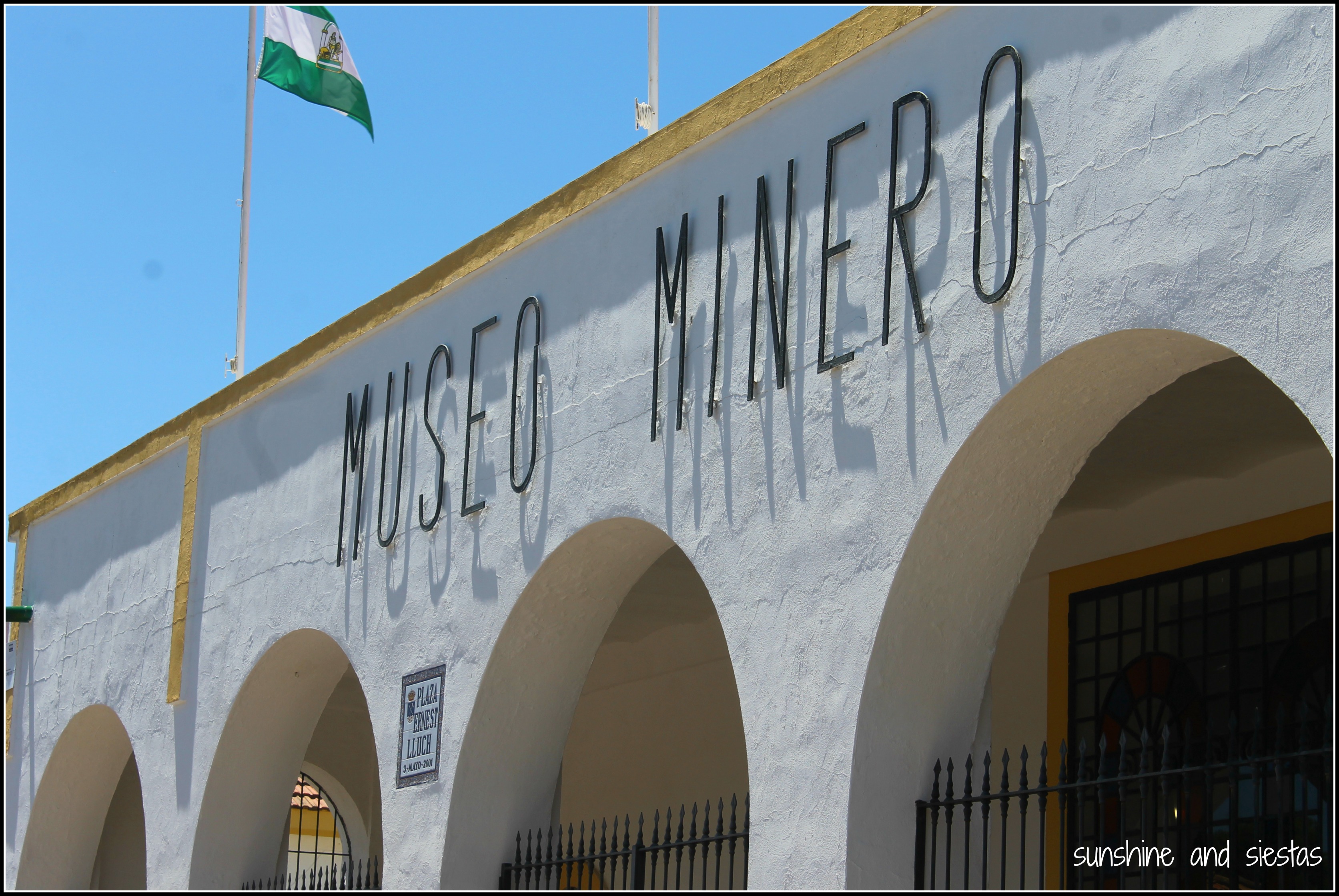
We arrived at the Visitor’s Center, housed in the old mining hospital and current mining museum, around 1:50pm. We were surprised to find it still open when most people would be having a leisurely lunch. The museum monitor told me that there were four big ticket options in town: the museum, a replica of a Victorian House, a visit to one of the mines with a guide and a touristic train ride, but that we’d arrived too late in the day to do it all. Don’t arrive midday and expect to be able to see all of the attractions – you’re better off starting early, breaking in the middle of the day for lunch and taking the train for the grand finale.

Mining Museum Spain

Kelly and I, as Chicago natives, have likely visited the Museum of Science and Industry and its mining exhibit a dozen times each, but we knew next to nothing about mining or the history of Ríotinto. The museum was a definite, but we had to choose between the mines and the touristic train. I was about to flip a coin when the monitor stopped us. “Don’t skip the train ride,” he told us. “The visit to the mines is interesting but not as esteemed as riding an old steam train.”

Steam Locomotives Huelva

Museo Minero en Riotinto Huelva

Signs all around the museum prohibited photography and videography, but having entered the museum so late we had missed the last guided tour – this meant we didn’t have to elbow past a group. They all stood baffled as they attempted to take photos on their mobile phones. If the guide wasn’t ruffled that they were deliberately breaking the rules, I certainly wasn’t going to clandestinely take out-of-focus photos on my cell. Ignore the posters.

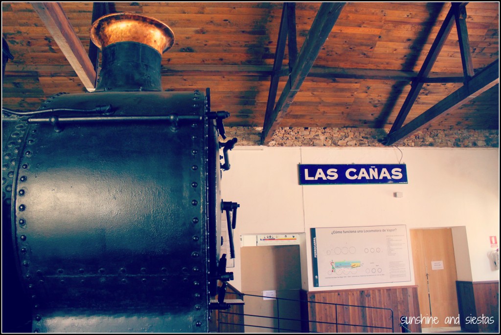
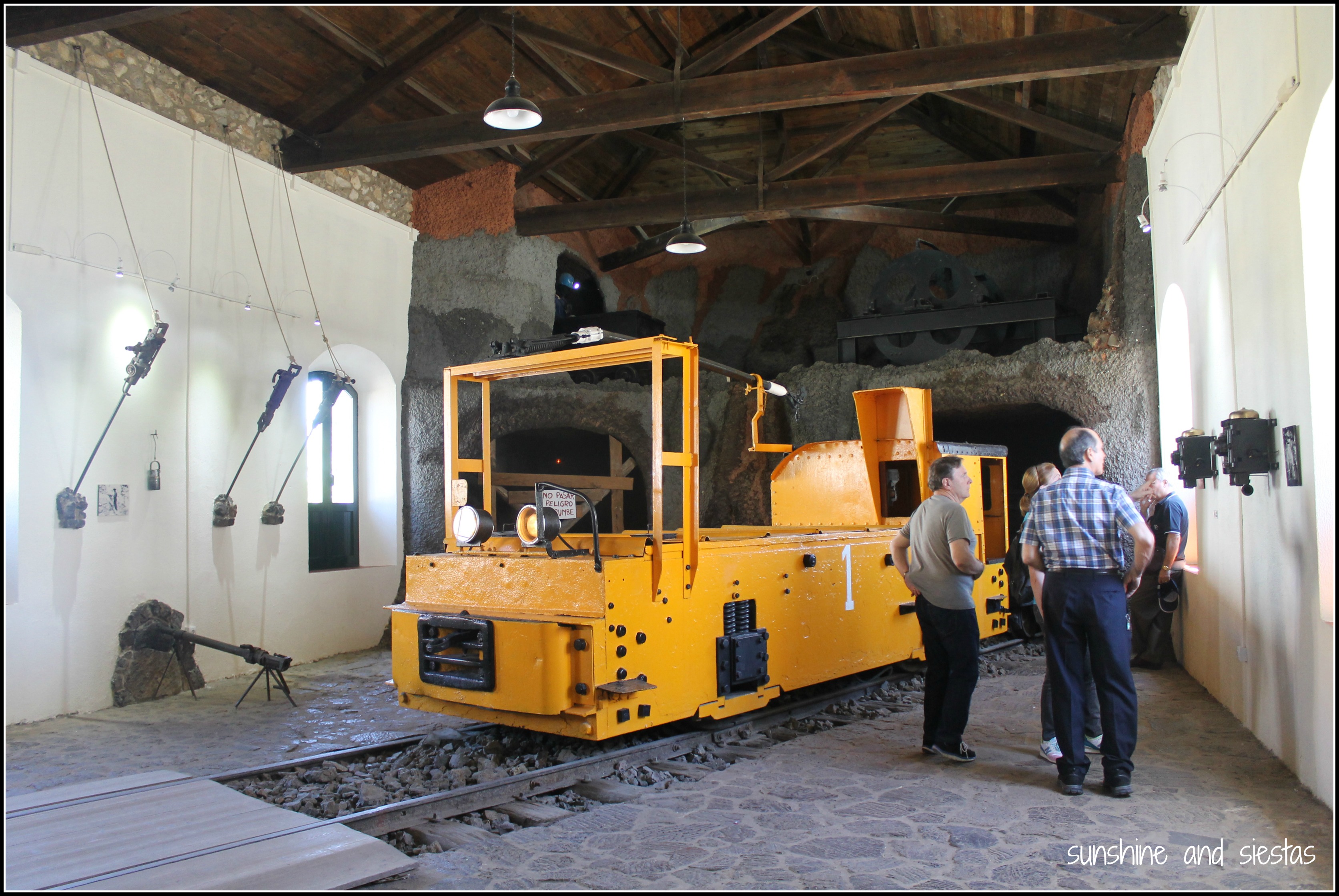
The museum was small but traces mining activity in the area from the Roman times – complete with an underground replica of a mine – to modern day. Three trains take up residence in the old hospital alongside cancelled train tickets, RTC Ltd.-issued uniforms and excavated gemstones.

Promptly at 3pm, we were ushered out. I had seen that one of the town’s five restaurants was renown for their English take on Spanish dishes. At La Epoca, you can’t miss the menú turístico, a three-course meal served every day of the week for 9,50€. When the Riotinto Company took over the mines, they brought their traditional dishes and savory sauces: I chose an omelette of locally grown vegetables and pollo al riotinto, a battered and fried chicken breast in coronation sauce.

Restaurante La Epoca Riotinto

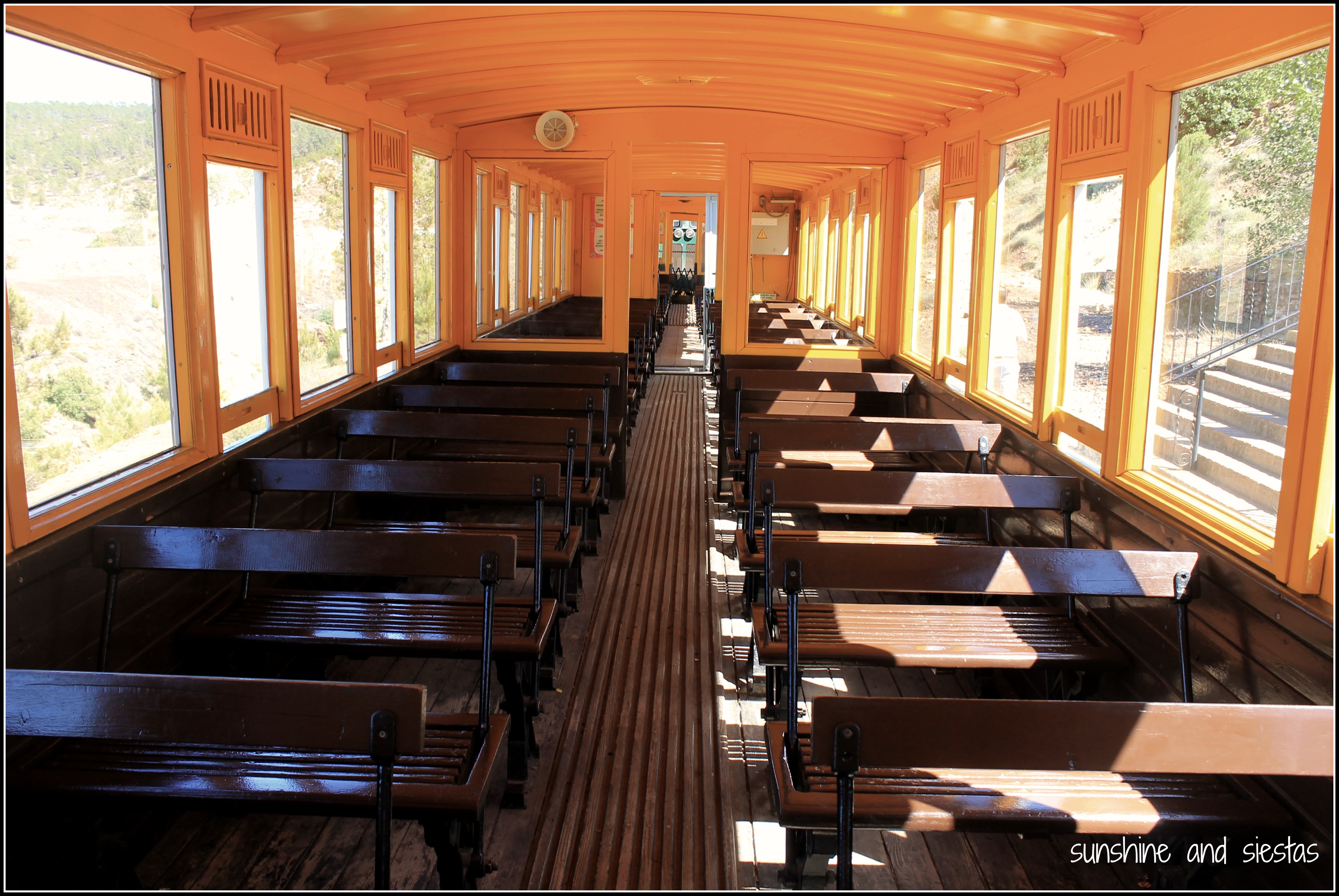
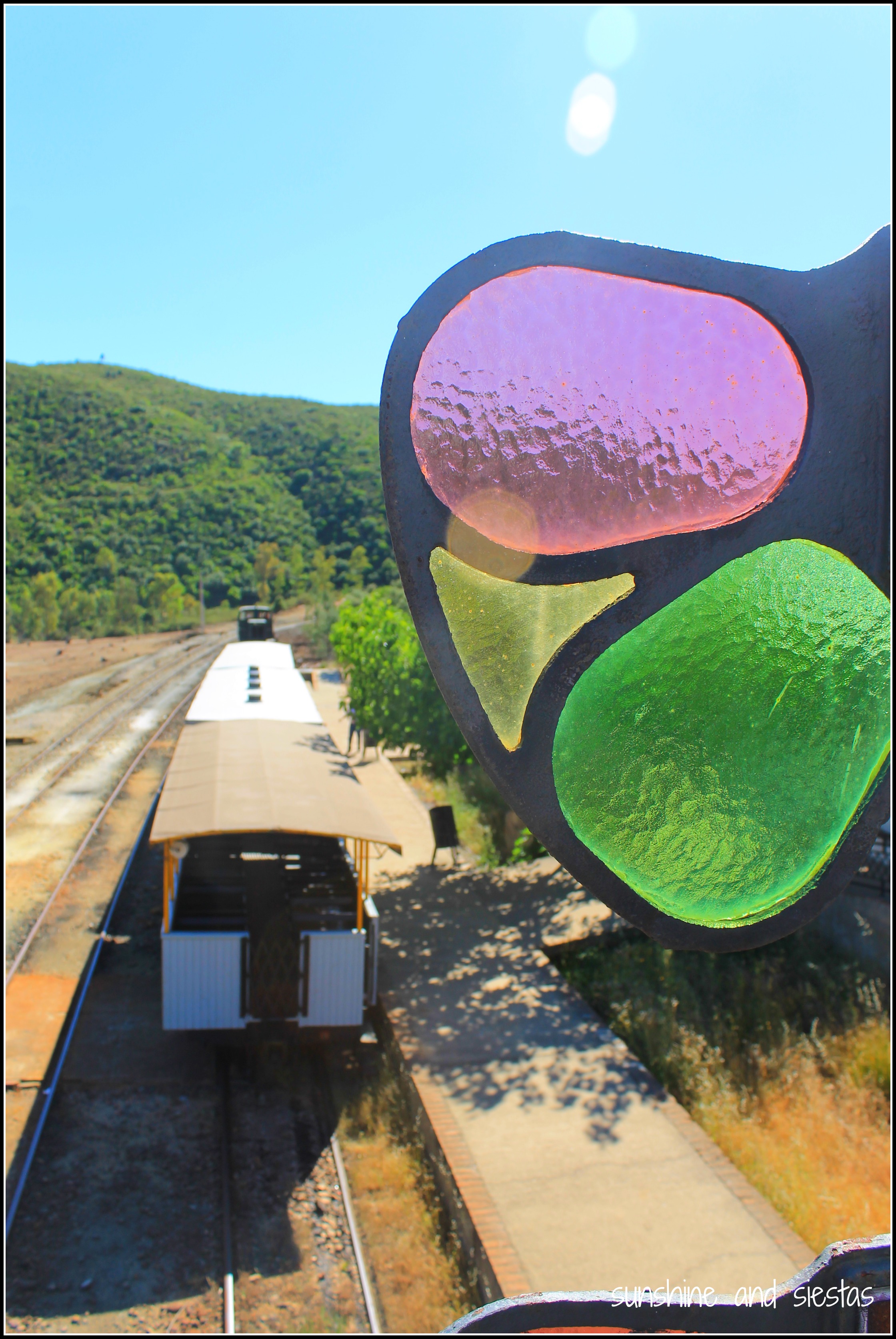
The scheduled departure time for the touristic train was 5pm, but don’t worry too much about being on time for the train. We left at 5:17, seated aboard train cars once used to transport passengers between the various excavation sites. The mines employed 3,000 laborers in their heyday, and the train line that joined the mines and the province capital of Huelva was traversed by more than 1,300 transport cars, used to move both men and might.

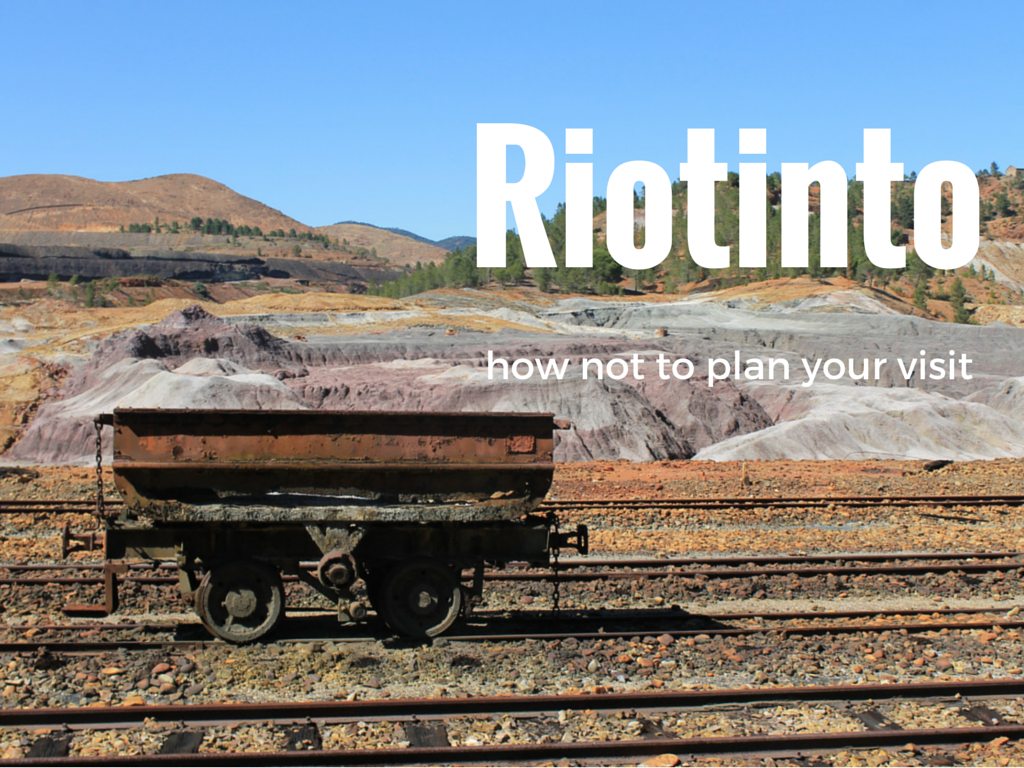
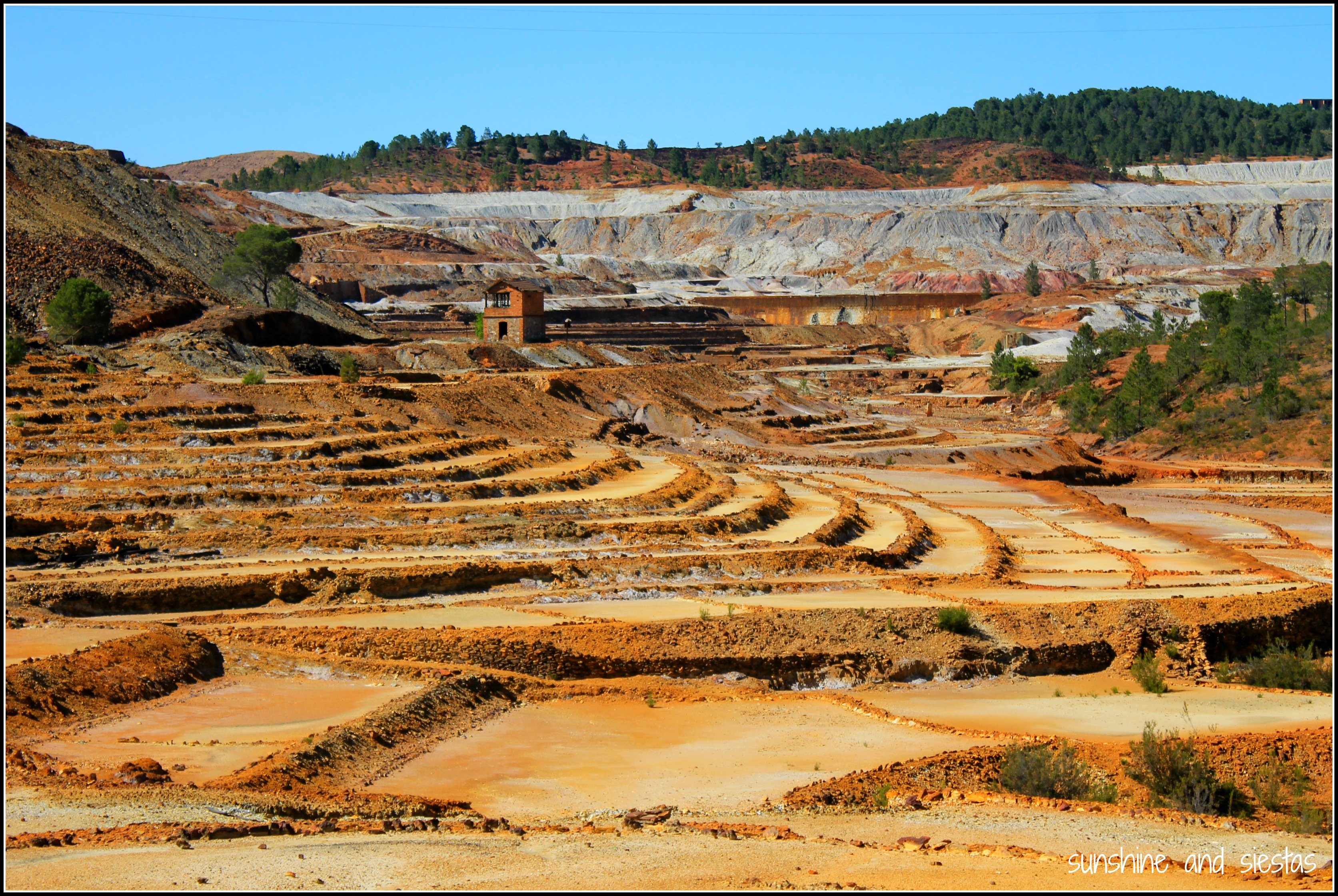
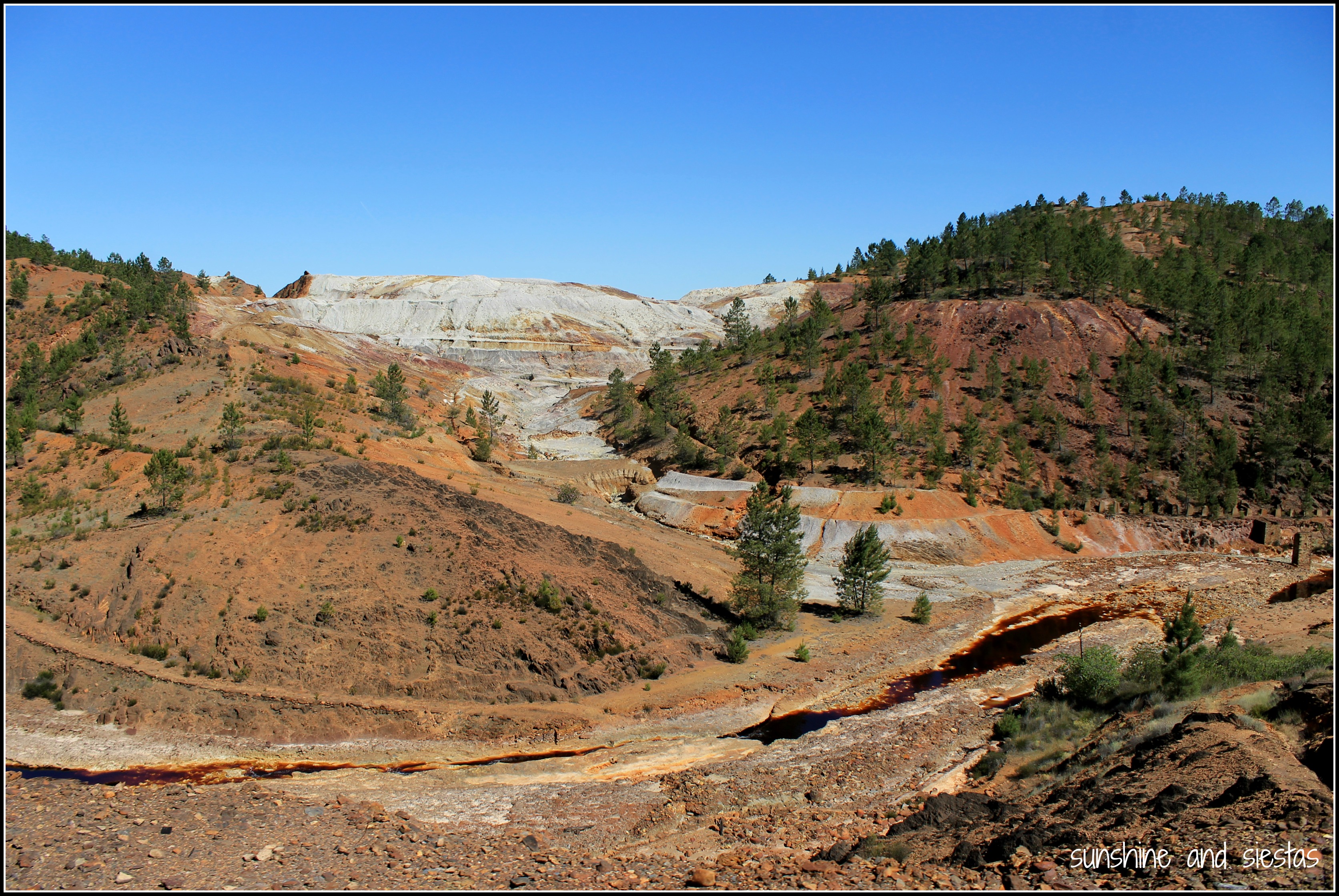
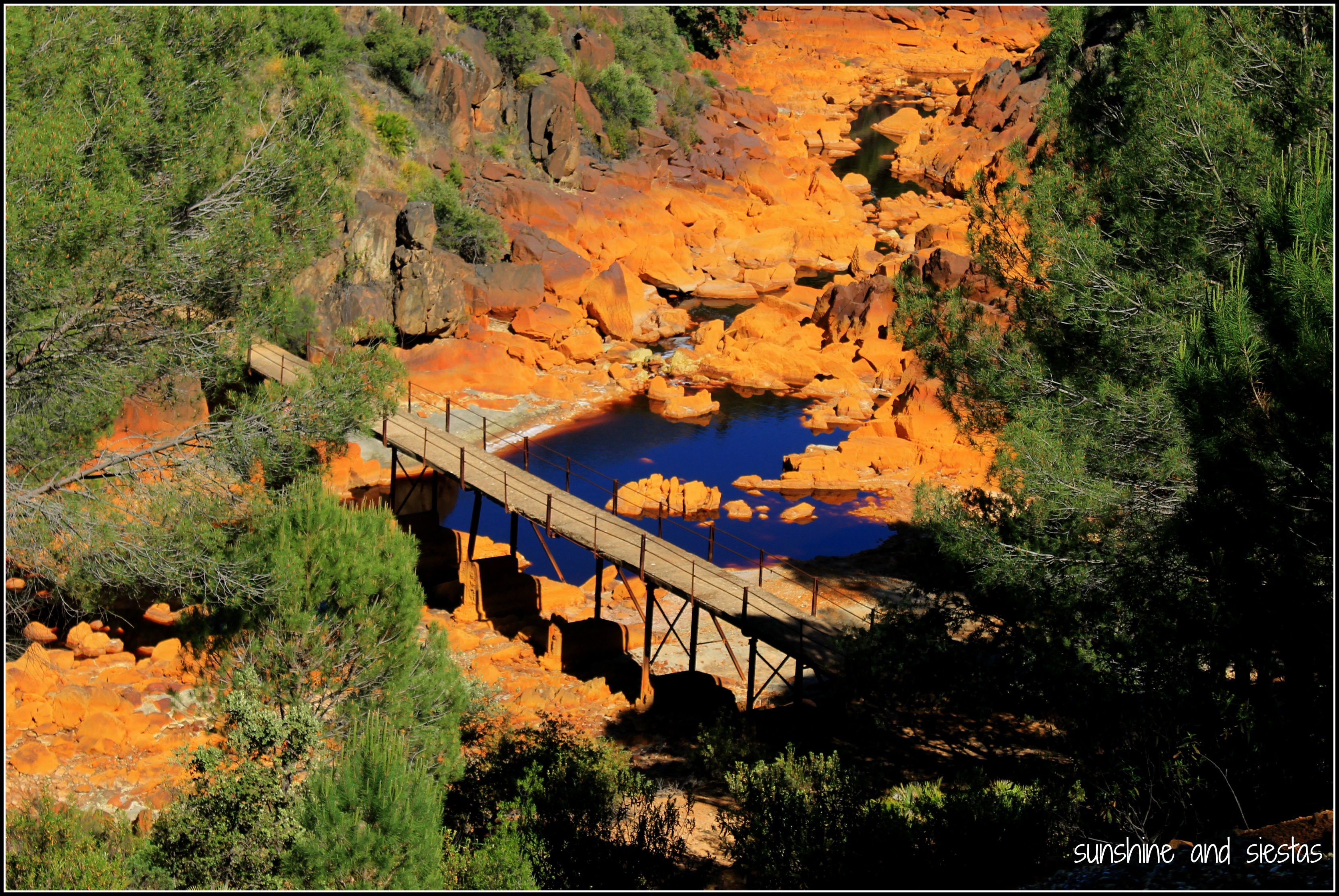
The 12 kilometer journey was slow to start, taking in the alien-like landscapes that reminded me of Teide. Definitely don’t forget your camera because the trip is scenic, if not eery with hollowed out mine cars, abandoned equipment and tracks that lead to nowhere.

Touristic Train of Riotinto Huelva

Touristic Train Minas de Riotinto

rio tinto railway

El Río Tinto is so-called for its crimson color – it literally looks like red wine – and believed to have a chemical component that is heavy in metals and iron. While no animal or fish life can be traced, bacteria thrives. In fact, NASA studied the chemistry of the water and concluded that Río Tinto is the place on Earth that most resembles samples taken from Mars.

visit to Riotinto

Landscapes of Rio Tinto Huelva

Spain's Red River Río Tinto

El Madroño and the Mines

Red River in Spain

Rio Tinto and its Color

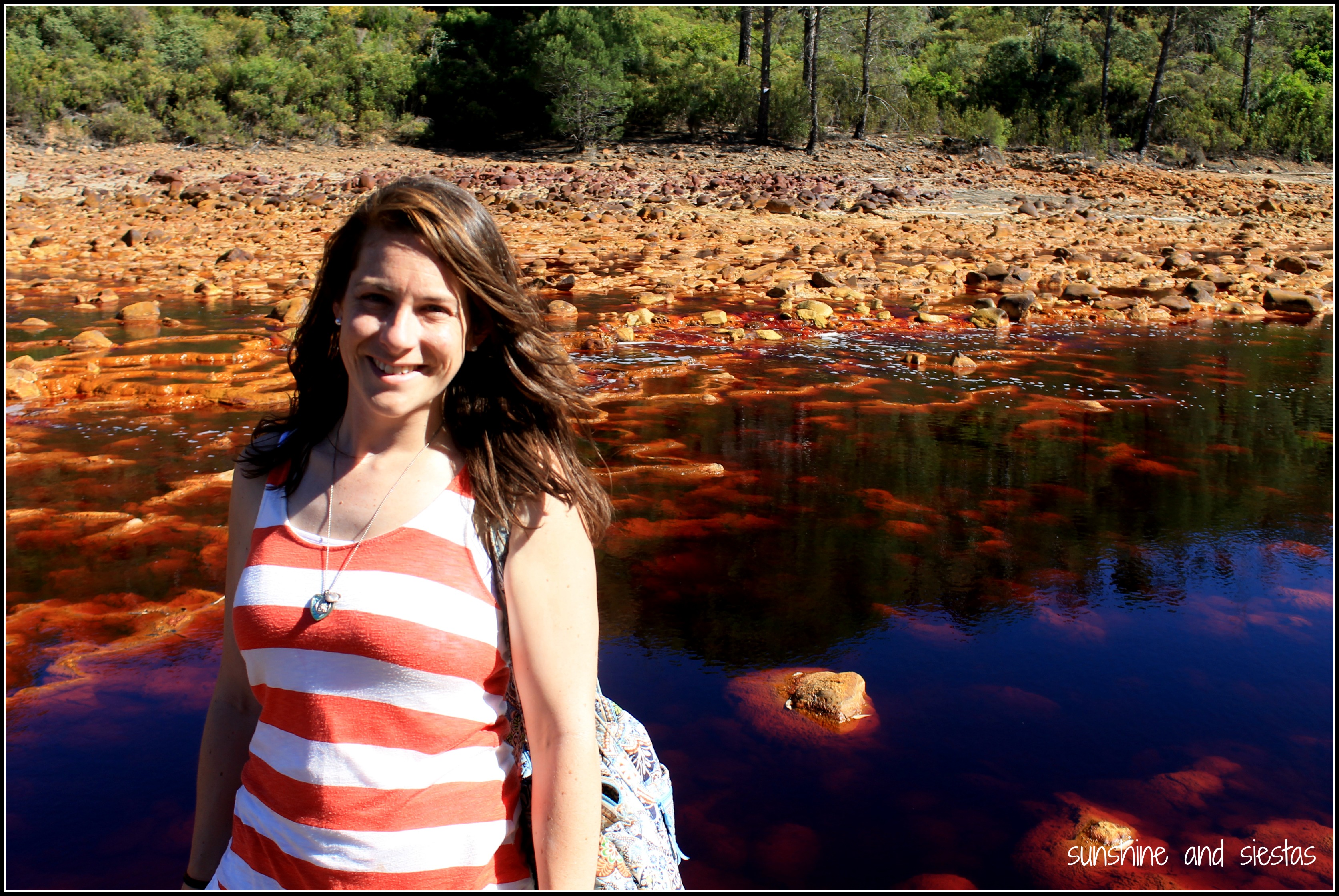
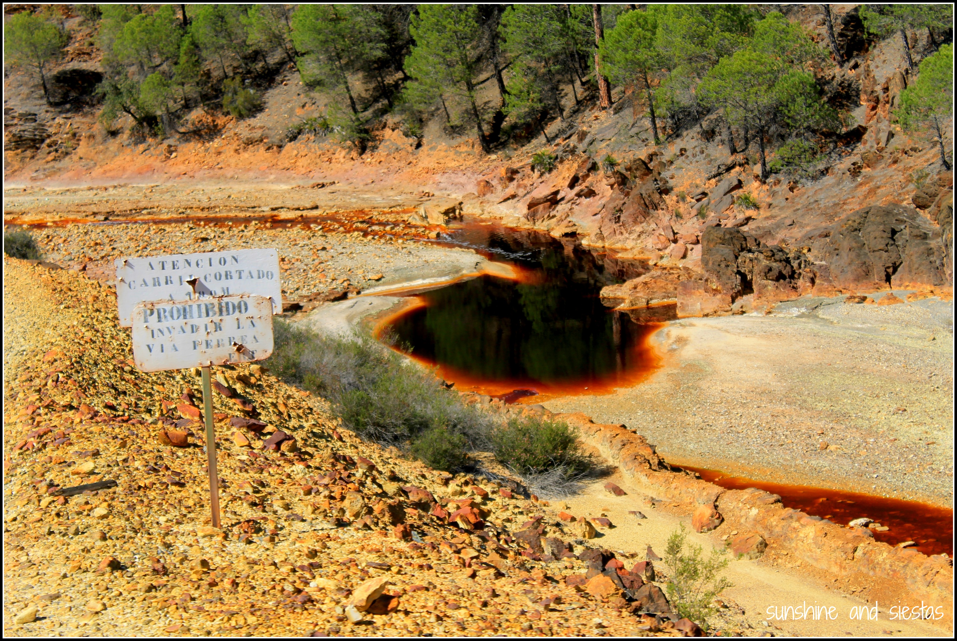
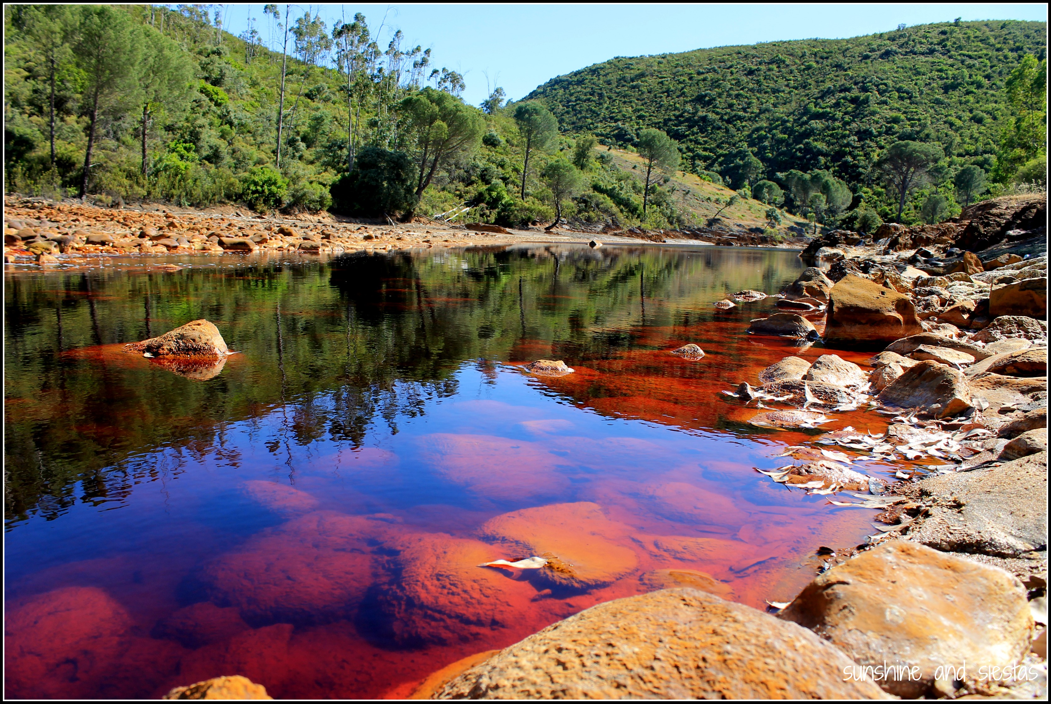
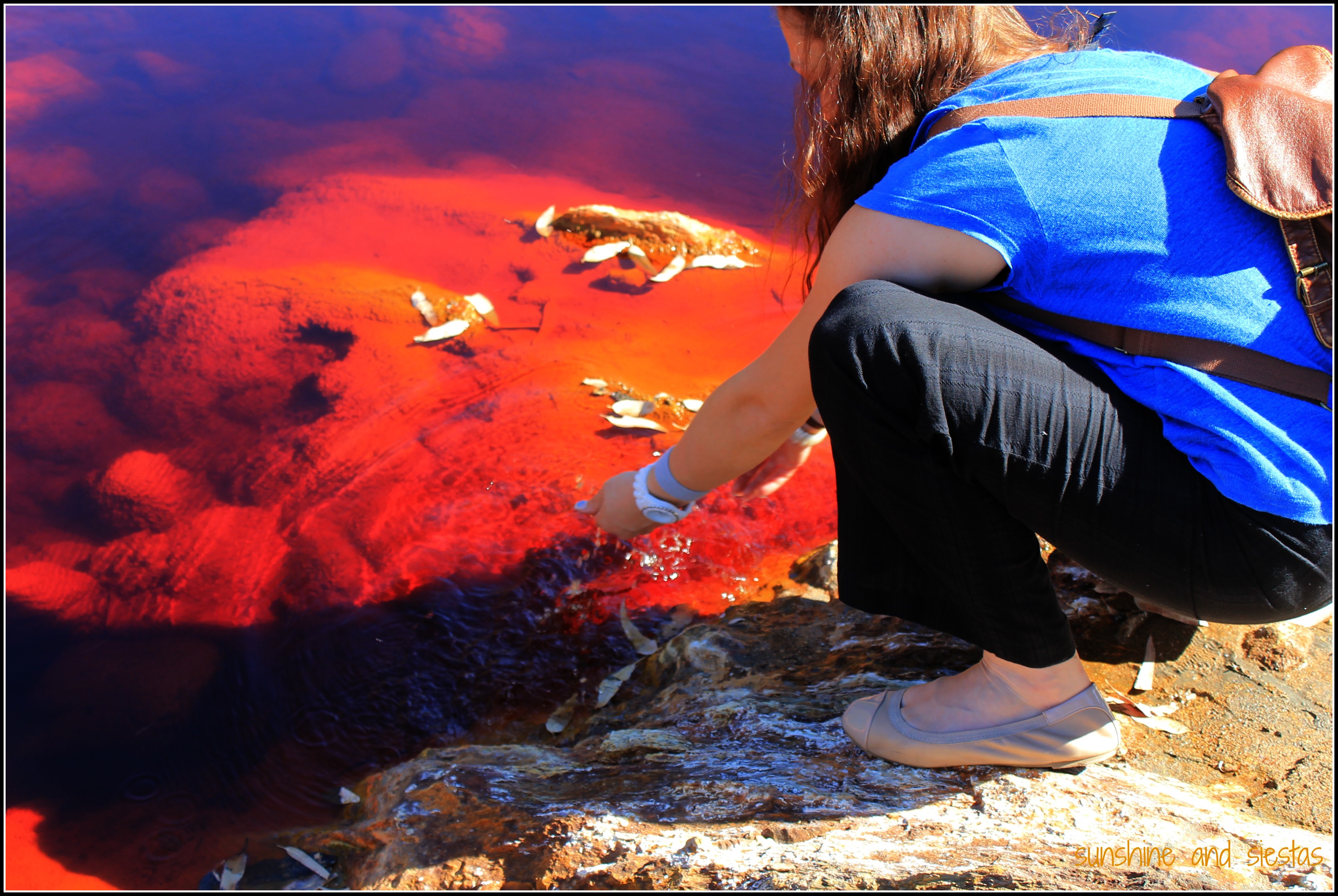
Don’t be afraid to touch the water or bottle some up as a souvenir – though the water will stain your clothes, it won’t do any harm to your skin. And if you do get off the train, don’t expect to call samesies on your seat – all of the Spanish abuelos will have changed spots, looking bored and fanning themselves before the train pulls away.

After so many years of living in Seville, I’d seemingly done all of the day trips. The mines and museums of Riotinto stayed off my list for years, so if you have a car and a free day, don’t miss it.

If you go: Minas de Riotinto is located 90 kilometers from Sevilla. The museum, Victorian House, mine visit and touristic train are open daily except for New Year’s, the Epiphany and Christmas Day. Plan to spend a day and around 20€ for the whole visit. Follow my advice and check the website for opening times. 

Logo TNS-01

I visited Ríotinto as part of the Typical NonSpanish Project, meant to show a different side of Spain and power by Caser Expat. All opinions, text and photo are my own.


Have you ever been to Ríotinto or had an unplanned day turn out to be awesome?

The World’s Most Dangerous Footpath: Walking the Caminito del Rey

The wind whipped by me as the park attendant handed me back my camera, dislodging my lens cap. As if in slow motion, I imagined it careening down the gorge and ending up passing through the hydroelectric plant to the south. 

Instead, it landed in the cracks between the newly placed wooden planks that made up the boardwalk. I breathed a sigh of relief.

“That was close,” the monitor said, stooping to retrieve it. “It’s 110 meters to the bottom.”

El Caminito

Even though planning my wedding and buying a house has left me pretty grounded, I prescribe to the “Have car, will explore” philosophy. When I heard about El Caminito del Rey, buried deep in the Málaga province, I wanted to plan a visit to what’s been known as one of the most dangerous hikes in the world.

Originally inaugurated over a century ago, this one-meter wide walkway became infamous internationally when five climbers fell to their deaths between 1999 and 2000. A decade passed before the Junta de Andalucía and the Diputación de Málaga agreed to saddle the costs of repairing the footpath that was christened with its present name after King Alfonso XIII traversed the one-meter wide trail when inaugurating the dam.

The Caminito fell into disrepair due to its hastily constructed path of concrete and sand, rendering it extremely risky to anyone who had the gall to pass it. I’ve seen images of climbers scaling rock faces, teetering over rusted metal rails and even perched on the edge of the balcones.

But by the time I was ready to try, the path was scheduled for a huge face lift.


Entering El Chorro from Ardales, the one-lane path climbed steeper and turns became tighter. Almost at once, my car was plunging into a valley of pine trees and slate a I watched the kilometer signs tick closer and closer to zero.

Then I got caught behind an interurban bus, a true sign that the Caminito del Rey is now accessible to anyone who can walk and not give in to vertigo.

A view of the Desfiladero de Gaitanes

I rounded the bend after the Virgen del Valverde hermitage, and my car spit me out onto a wider paved road. I immediately saw the small crack in the cliff that made up el Desfiladero de los Gaitanes, the old rickety pathway just beneath a more linear, safer replacement and the famous bridge between the two rock faces.

My GPS had long stopped giving me precise location updates, so I found a place to park near the visitor’s cabin nearly 90 minutes before my assigned entrance time at 2pm. 

protective headgear for the Caminito del Rey

Safety precautions have made El Chorro’s big draw a bit lackluster. Rockslides, jumpers, wind and other natural elements have been controlled, experienced climbers hired as monitors and protective helmets purchased for every hiker. If not for the thrill, go for the views.

Hiking to the Caminito del Rey

I wobbled a bit on the stairs that led to a 200-foot stretch of wooden pathway, stepping awkwardly as I tested out my nerves. The same wind that nearly blew an umbrella into me at the bar an hour earlier had picked up. My steps down became sideways to put as much ground under me as possible.

I’ve never been afraid of heights as a former gymnast, so I had no images of falling to my death when I entered the tramo of walkways just past the control cabin – I was more afraid of dropping my ID card or cell phone after taking panoramic shots of the gorge and damn below.

Crossing the Caminito del Rey

German, French and Spanish tourists clogged the beginning of the trail, as many were returning the same way they’d come (and hugging the rocks, making it easy to pass by them). Because the path is linear, hikers now have the choice of entering from the north or south, and of returning by bus or on foot, crossing the desafiladero once more.

As if a death by fire rather than rocks were necessary, the first big moment from the south entrance is crossing the suspended bridge. Spanning the gorge, it’s the most exposed you’ll be to the elements on the whole trek.

Hanging Bridge in Malaga

Posing for a photo on the Caminito

Many parts of the old path have been left as a reminder of the origins of the route – I was either walking directly over it or just above it. In fact, when the Caminito was provisionally closed in 2000, the local government actually demolished the beginning stages to discourage climbers. This only made the leyenda negra grow and attract daredevils from around the globe.

the Old Pathway of the Caminito del Ret

the pasarelas of the Caminito

Pathways between the mountains on the Caminito del Rey

puente del rey

The Caminito is extremely tame since the reopening. At no moment did I feel like I was going to blow off the side of the gorge or lean too far over the railings. I wasn’t terribly disappointed – the day was sunny and temperate, the views of the Valle del Hoyo and the Pantano were as jaw dropping as the gorge itself, and I, for once, wasn’t attached to my computer.

Malaga Caminito del Rey

Hiking in Spain on the Caminito

Traversar el Caminito del Rey
When is the Caminito open? Do I need reservations? 

The Caminito del Rey is open every day but Monday, weather permitting. You MUST have a reservation to enter, as only 50 visitors are allowed every half an hour. I snagged a free entrance through the website a few weeks before the reopening.

What should I bring? Are there restaurants on the Caminito?

are there restaurants near the caminito del rey

Be sure to bring sunscreen, water and sturdy shoes. You’ll also need your entrance ticket and ID card or passport. There are no facilities along the trail – not even garbage cans – so you should use the bathroom and pack any food or water you might want to consume.

How can I get to El Chorro?

El Chorro is a neighborhood of Álora, located just up the hill from the visitor’s center. There are various ways to get there by car, but often on poorly serviced highways. From Seville, I took the A-92 towards Granada, turned south at Osuna and headed to Teba, turning off at Ardales and onto the MA-4503. The whole trip took just over two hours.

access point of the caminito del rey

From Seville, the Media Distancia train towards Málaga will also leave you in a train stop marked ‘El Chorro,’ and vice-versa. Schedule here. Due to road closures along the MA-5403, the train trip is probably preferred in summer 2015 – it will take the same amount of time and cost you the same amount of money from Seville as a car will.

How long is the Caminito, and how long should I plan to be in El Chorro?

The most famous part of the Caminito is, without a doubt, the walkways. Now equipped to support up to 50 people at a time and featuring handrails, the walkways, called pasarelas, constitute about three kilometers one-way.  

Valle de los Hoyos Málaga

There’s a 1.6 kilometer trek uphill to the official entrance point of the walkways from the southern access at El Chorro, another 2 or so in the Valle del Hoyo between them, plus 2.7 to the northern entrance point in Ardales. Round-trip is close to 14 kilometers round-trip, so plan on 4-5 hours. If you don’t want to walk back, you can grab a bus once an hour, whose schedule is here.

More information is available on the Caminito website.

Looking for more outdoor activities in Southern Spain? Check out my articles on the Vía Ferrata, the Minas de Riotinto and the Via Verde.

Elephant Riding in Rajasthan: Good Idea, Bad Idea?

“Ok, you have one minute to decide: ride elephant, walk.”

Ali swung around, eyebrows raised. His heavily-decorated tuk tuk’s engine shivered as it halted to a stop and he used his leg to steady it. I looked at Hayley and took a deep breath. “I can’t do it, I’m sorry.”

The city I most looked forward to visiting in India was Jaipur, a metropolis dubbed “The Pink City” that is famous for its salmon painted buildings and the Amer Fort. Once we’d gotten our bearings in Delhi and Agra, Hayley and I were set to enjoy endless lassi yogurt drinks and climbs to some of India’s most jaw-dropping forts and palaces.

Other travelers told me that Jaipur rises out of the desert like a mirage, but we rolled in on a sleeper train that was delayed several hours through a seedy part of town. The porter knocked on the door and motioned for us to get off. Jaipur, after Delhi’s chaos and the scam-laden town of Agra, was already a dream.

Ali stood, arms crossed, waiting to take us to Hotel Kaylan. Though illiterate, he pulled out a journal that was full of recommendations and reviews from other traveler. He stood up and opened the compartment under his seat, taking out a photo album so we could settle on an itinerary.

Apart from the city’s main sights, like the various forts and palaces, the Janta Mantar and the Hawa Mahal, he pushed the Elefantastic park, allowing us the opportunity to paint, feed and swim with the pachyderms. After all, the Rajasthani state is famous for its Indian Elephant festivals and breeding grounds, and elephants have been used for centuries in trade and commerce. What’s more, one of Hinduism’s most beloved gods, Ganesh, the god of good fortune, is depicted as an elephant.

Ali drove us to the Monkey Temple at sunset. Animals are quite commonplace in the streets in India – not only are sacred cows able to freely roam cities and eat all the trash they can find, but we saw goats in rickshaws, pigs and warthogs complacently lying on patches of cracked cement, and now monkeys swinging about temples as the faithful prayed.

India is different when it comes to animal treatment. As an American, I’ve always had a pet and have been taught to respect animals. My parents contribute to the National Parks System and sent me to summer camp as a kid, and I’ve been riding horses since I could walk. That said, I eat meat and would probably defend a human over any other four-legged creature.

I found India to be a strange paradox: Gandhi once said that you can measure a nation on how they treat their animals, but there were scores of abandoned creatures. In fact, I didn’t see an animal on a leash until our last morning in India.

We spoke softly to a man who carried around a bag of mangoes and spoke good English. Despite leaning on a cane for support, he’d been climbing up the slippery slope that wound up a steep mountain a few times a day to feed the massive flock of Rheus Langur monkeys that lived in the vicinity of three small temples.

We’d given the Amer Fort a full morning before hiring Ali to take us to the Mughal markets for shopping. But I was still faced with the decision of whether or not I’d want to ride an elephant up to the magnificent, sprawling residence. We spent the breezy night up on Hotel Kaylan’s terrace restaurant, sipping fizzy soda water flavored with lime and salt. While Hayley settled something with her bank, I dove into researching elephant treatment in Rajasthan. 

Part of the hesitation about the ride came from participating in the Travel Blogging Calendar to raise money for Thai elephants. After being clued in to exactly what happens to elephants when they are tamed there, I would have been horrified to support a rehabilitating practice.

I was encouraged to learn that the Indian Government opened and has sponsored an elephant compound since 2010, meant to be a refuge for the pachyderms and a tourism center for Indian elephants. There’s also an Elephant Wellness Office to which abuse and mistreatment can be reported.

The 100+ elephants working at Amber Fort have specific rules about how many trips they can make per day and are limited to two passengers, plus their Mahout, or handler. In fact, most are able to stop working for the day by 11am, before it gets too hot. No downhill trips are permitted.

But get past the first few pages of Google, and the horror stories crop up – elephants dying of heat stroke, of mahouts being trampled to death, of lack of funding for sick and suffering animals. I didn’t even bother investigating how the animals were trained.

The issue, of course, is not black and white. As animals have traditionally been domesticated by man for millennia, and this sort of tourism is crucial to many communities in India, I began to weigh those points as well. The Novio has trained horses and dogs, and his family relies on animal to earn their living, so would I be hypocritical by refusing to take the ride when I’ve ridden horses and camels?

By the time we went to sleep, I was still uneasy about the decision I’d have to make. I’d imagined elephants would be a part of my India experience, just as dosas and a guru reading my chakras and learning to drive a tuk tuk were.

Ali showed up early the following day to pick us up and take us for a lassi before driving to the palace. He pulled off the road adjacent to the Maota Lake and asked: to the elephants, or are you walking up?

I had asked his opinion on the ride, and he admitted that he wouldn’t think about doing it. Ever. Full stop. Ali is a spiritual and respectful man, so I trusted his judgement.

We set off walking, having to dodge hawkers and other tourists on the ramp and stairs that lead to the Suraj Pol, or Sun Gate.

When I saw my first elephant, trunk decorated with paint, I gasped. Having only seen elephants in zoos, I couldn’t believe I was just a few paces away from one – so surprised, in fact, that I narrowly missed a pile of fresh poop.

The climb itself was incredible, and we passed by the elephants through narrow gates. I didn’t, for one second, regret my decision to forgo the ride – it looked shaky, so I wouldn’t have gotten any good photos anyway.

Watching the passengers dismount in the lower courtyard, called the Jaleb Chowk, the elephants turned around and went back the way they came. I couldn’t deny that it was beautiful to watch them sway as they left the sun gate and went back for the next batch of passengers. 

Elephants, in Hindu culture, represent strength, prowess in war, majesty and royalty, and a vehicle to the divine world. But in no way does a vehicle to the divine world mean sitting on top as the elephant trudges up a slope.


This article was written as part of Contiki Storytellers’s campaign for Costa Rican sea turtles (please watch the video above!). Animals are an important part of ecosystems, after all. I cannot tell you it’s right or wrong to ride an elephant in India or Thailand or elsewhere, merely that you investigate and make the decision based on your personal feelings. I am not a conservationist or an animal rights activist – I’m just a traveler who didn’t feel right taking an elephant ride. I was not paid for this article.

What’s your take on animal tourism? I’d love to hear from other bloggers like Green Global Travel, Wanderlusters and Hole in the Donut, who are into responsible tourism.

The Amer Fort is located 11 kilometers from Jaipur in the village of Amer and is open daily from 7:30am until 5:30pm. Foreigners pay a 200 rupee entrance fee (about 3€). The cost of riding an elephant is 1000 rupee for two people, plus a tip for the driver.

Spain Snapshots: A Visit to Spain’s Highest Point, el Teide

The Megane steadily climbed out of Santa Cruz de Tenerife, past La Laguna and into the plush interior of the island. The pines and windy roads took me back to Colorado, but with an occasional glimpse of Atlantic waters.

Gua guas pushed up the hill slowly, and Forrest swerved around them, comfortable as he shifted into third in our rental car and rode the mountain up. Tenerife was formed by an underground volcano 30 to 50 million years ago, and its highest point, Teide, actually gives the island its name: tene (mountain) and ife (white), joined by an /r/ during the colonial period. The entire island is formed from volcanic rock, in fact, evident from the steep ride up and down, and the white-capped mountain is visible from seemingly every rincón of the largest island in the archipelago. 

Once we reached the national park and UNESCO World Heritage site, we parked the car and took the gondola up the mountain. Most tourists don’t venture up to the top, standing nearly 3800 meters above sea level, despite Teide being one of the most visited sites in Spain. The landscape is almost barren, and the only sign off life we saw after starting our ascent were lizards.

Steep rock stairs have been carved into the rock face, but we still scrambled over boulders, stopping for vistas and water breaks every 10 steps because the air was so thin. 

The great crater caused by multiple eruptions in visible from just about everywhere on the island, but seeing it from a bird’s-eye-view was insanely cool.

From the very top, you can see Gran Canaria to the east and la Gomera to the west. We actually hiked above the cloud level that covers the occidental side of the island, watching them get burned off by the warm midday sun.

If you go: Visitors can take the gondola up the mountain at the cost of 25€. If you want to hike to the top, you’ll need to print off an access pass on the national park’s main page. It’s free, but you’ll have to bring a form of ID.

Be sure to dress in layers, as it’s cold at the top, and wear comfortable shoes. Bring sunscreen, sunglasses and plenty of water, as there are no facilities after leaving the visitors center.

Have you ever visited a national park in Spain?

My rental car was graciously provided by Car Rentals UK. All opinions (as well as the memories of my stomach dropping during the hairpin turns) are my own.

Climbing the Via Ferrata of Archidona

Something hard hit my boob. I watched a rock about the size of a plum careen down the grassy knoll before rolling to a stop. I squinted up at the rock face. There was a lot of mountain to go, and it had already beaten me up.

The via ferrata is the Italian name given to the iron railings the Italian army used in WWI to scale the Alps and the Dolomites, which may have existed a century or two before. The peñón of Archidona is certainly not the Alps, but as a first time climber, my legs were shaking before I had even strapped my kit to the long wires extending more than 140 meters vertically.

Franci explained the procedure to us once more –  to use the mountains, take off one carabiner at a time and don’t panic. I watched Meg Spiderman crawl over the first half a dozen before I took a deep breath and pushed off the ground, grasping the iron peg above my head.

Reaching the top a few hours later (there were periods of waiting for slower climbers or turns to cross the bridge that spanned a canyon) was a tad anti-climactic because my legs were tired and I’d already seen this view of the town below and the mountains that enclose it. My hands were red and raw and I could feel my nose burning under the hot sun.

We started down the mountain – this time walking – and snaked back around to the cars.

Facing things that make me nervous gives me just as much satisfaction as a really good meal and a glass of wine. Yeah, I like being outdoors and trying new things, but I’m not an adrenaline junkie. That said, I’d consider doing other activities that Ocioaventura offers, like spelunking or rafting. Anything that allows me to keep my two feet on the ground!

Ocioaventura offers a half-day Via Ferrata pack, which includes equipment rental, insurance and a basic training course, plus the climb, for 45€. Be sure to wear comfortable clothing and shoes, put on sunscreen and eat beforehand. You’re able to carry a small backpack for water. The course in Archidona is for beginners and can be climbed in 2-3 hours.

And if you’re looking for a place to stay, be sure to check availability at Almohalla 51, a beautiful boutique hotel that will only require a quick uphill trek from the main square.

Five Reasons Why Lanzarote Should Be On Your Travel Radar

The month of March for me will be centered on the Canary Islands – not only will I be visiting Tenerife for the first time, but I’ll also be heading to Trujillo to redeem a prize from a writing contest, in which I wrote about a memorable meal on Gran Canaria.

For the future, I can’t overlook Lanzarote, as the easternmost island’s biodiversity, gastronomic treats and jaw-dropping beaches merit an epic road trip around the bean-shaped island.


Most tourists flock to Tenerife or Gran Canaria, but here are five reasons why Lanzarote is a must-see in Spain

And it’s not all golf courses and spas on this vacation paradise – leaving the Tenerife trip planning to my local friend, I began to delve into what Lanzarote has to offer.

The Beaches and Biodiversity

Known to have been formed by underwater volcanic eruptions, Lanzarote has been crowned with a Biosphere Reserve through UNESCO for its richness of flora and fauna, as well as its unique geology. In fact, over 40% of the island has been designated as protected area, the most famous being the moon-like volcanic landscape of Timanfaya National Park.

source

There’s also a number of geological sites due to multiple eruptions and underwater volcanic activity. Visit the Jameos de Agua, el Golfo volcanic lake or  the Cueva de los Verdes – they look insane!

And thanks to its miles of coastline, the beaches on Lanzarote are famous for their beauty and their wind sports. Those near Puerto del Carmen are where you’ll find a number of tourist-friendly amenities and all-inclusive resorts, but Yaiza’s white sand beaches and the lunar-like stretches near Tinajo shouldn’t be missed.

The Gastronomy

The gastronomic history of Lanzarote is astounding, rich in vegetables and fish. After tourism, agriculture is the most important industry thanks to its wine-growing regions and tough terrain. This also means that potatoes and yams are widely grown, and the most typical meat dishes are of goat and pork – a far cry from the paella and sangria touristic ploy.

source

Be sure to try a gofio, a simple, traditional gift believed to be eaten by the aboriginal people. Made of toasted grain flour, it’s typically eaten with stews or added to water to make dough. Cheese is also a big deal on the island, and several varieties are made.

The Weather

While most of North America and even Spain are caught in the worst winter weather of, um, decades, the Canaries experience an average temperature of 22° (and the average water temperature is close to 20°!) and about 12 hours of sunlight in the summer months.

source

Do note that if things gets hazy, it’s because of the sand blowing off of the Sahara Desert – Lanzarote is just 125km off the African coast!

The History

Believed to be the first settled island of the archipelago, Lanzarote has long been inhabited by Phoenicians, Romans and the objective of many European conquerors. It was even believed to be Atlantis by Plato!

Teguise is the historic capital of the island and, at one time, the political center as well. The small city has seen skirmishes and pirate attacks, and is now home to the island’s best museums. There’s also a weekly flea market on Sunday, and the city fills to the brim for the event.

Though a fair amount of the Canaries’ citizens is made up of expats, Lanzarote has a smaller concentration of foreign residents. Because it’s different from mainland Spain, the island merits a visit to see its unique way of life.

Getting to and around Lanzarote

The island is served by both an international airport and ferries from nearby Gran Canaria. Once on the island, renting a car is recommended, or you can cycle, surf, hike or even hitch a ride on the guagua.

Have you ever been to the Canary Islands? Any suggestions for Tenerife?

Related Posts Plugin for WordPress, Blogger...